


VTD-precinct 7, Union County, South Dakota
About
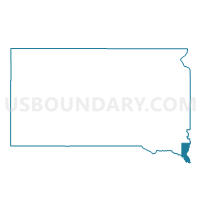
Outline

Summary
| Unique Area Identifier | 667835 |
| Name | VTD-precinct 7 |
| County | Union County |
| State | South Dakota |
| Area (square miles) | 72.62 |
| Land Area (square miles) | 72.60 |
| Water Area (square miles) | 0.01 |
| % of Land Area | 99.98 |
| % of Water Area | 0.02 |
| Latitude of the Internal Point | 42.82997140 |
| Longtitude of the Internal Point | -96.75649630 |
Maps


Graphs
Select a template below for downloading or customizing gragh for VTD-precinct 7, Union County, South Dakota


Neighbors
Neighoring Voting District (by Name) Neighboring Voting District on the Map
- VTD precinct 5, Union County, SD
- VTD-precinct 3, Union County, SD
- VTD-precinct 4, Union County, SD
- VTD-precinct 8, Union County, SD
- VTD-precinct W01, Clay County, SD
- VTD-precinct W03, Clay County, SD
Top 10 Neighboring County Subdivision (by Population) Neighboring County Subdivision on the Map
- Fairview township, Clay County, SD (522)
- Big Springs township, Union County, SD (275)
- Elk Point township, Union County, SD (261)
- Sioux Valley township, Union County, SD (243)
- Brule township, Union County, SD (242)
- Spink township, Union County, SD (218)
- Emmet township, Union County, SD (214)
- Garfield township, Clay County, SD (208)
- Richland UT, Union County, SD (198)
- Prairie Center township, Clay County, SD (190)
Top 10 Neighboring Unified School District (by Population) Neighboring Unified School District on the Map
- Vermillion School District 13-1, SD (12,235)
- Elk Point-Jefferson School District 61-7, SD (3,907)
- Beresford School District 61-2, SD (3,381)
- Alcester-Hudson School District 61-1, SD (2,273)
- Greater Hoyt School District 61-4, SD (305)
Top 10 Neighboring State Legislative District Lower Chamber (by Population) Neighboring State Legislative District Lower Chamber on the Map
Top 10 Neighboring State Legislative District Upper Chamber (by Population) Neighboring State Legislative District Upper Chamber on the Map
Top 10 Neighboring 111th Congressional District (by Population) Neighboring 111th Congressional District on the Map
Top 10 Neighboring Census Tract (by Population) Neighboring Census Tract on the Map
- Census Tract 201, Union County, SD (4,157)
- Census Tract 9658, Clay County, SD (2,897)
- Census Tract 202, Union County, SD (2,664)
Top 10 Neighboring 5-Digit ZIP Code Tabulation Area (by Population) Neighboring 5-Digit ZIP Code Tabulation Area on the Map
- 57069, SD (11,988)
- 57004, SD (3,356)
- 57025, SD (2,795)
- 51001, IA (2,432)
- 57001, SD (1,672)
- 57010, SD (493)